
If you’ve read a few of my books, you’ll know that I don’t very often venture into the Saxon lands on the north-west coast of England. (I know that Ealdorman Leofwine visits there in his second book, but I didn’t know better then). There’s a very good reason for this. I am, quite frankly, a bit scared to do so. Mainly because I don’t feel as though I can get a firm understanding of what was happening there during the Saxon era. (I would say the same about Cornwall/Devon – and that’s because there are various references to the area coming under Saxon control – only to be repeated a later period, so it clearly didn’t happen when some of the sources say it did).
Some research will highlight the Norse element of the area, and others will call it Cumbria, or Northumberland. And in the 830s, before the main ravages of the Viking raiders, it feels very unknown to me.
But, in Protector of Mercia, I do take young Icel to the north-west – no doubt to test myself and to see if I could do it.
I think we can start with Chester, which admittedly, would probably have been classified as being in Mercia. Chester, a former roman site, is well-known, even now there are standing Roman ruins. Admittedly, what Chester might have been like in the 830s is more difficult to pin point – so I had a bit of fun with that.
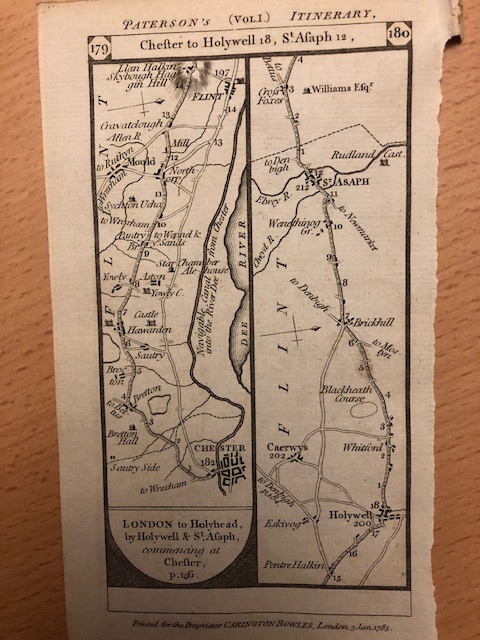
And after Chester? What then? I like to make use of old maps when I’m trying to reconstruct the past (the one above is a road map, so looks a bit unusual). Yes, they’re still positively modern but I find it easier than using Googlemaps where there’s too much ‘modern’ to look at. The starkness of antique maps isn’t always quite as extreme as on the map below of Cheshire from 1835 which shows the voting hundreds but there’s always something of value in them, even if its just revealing where the rivers are in relation to settlements – if you use Googlemaps you might become distracted by canals and other, much later, attempts to control rivers.

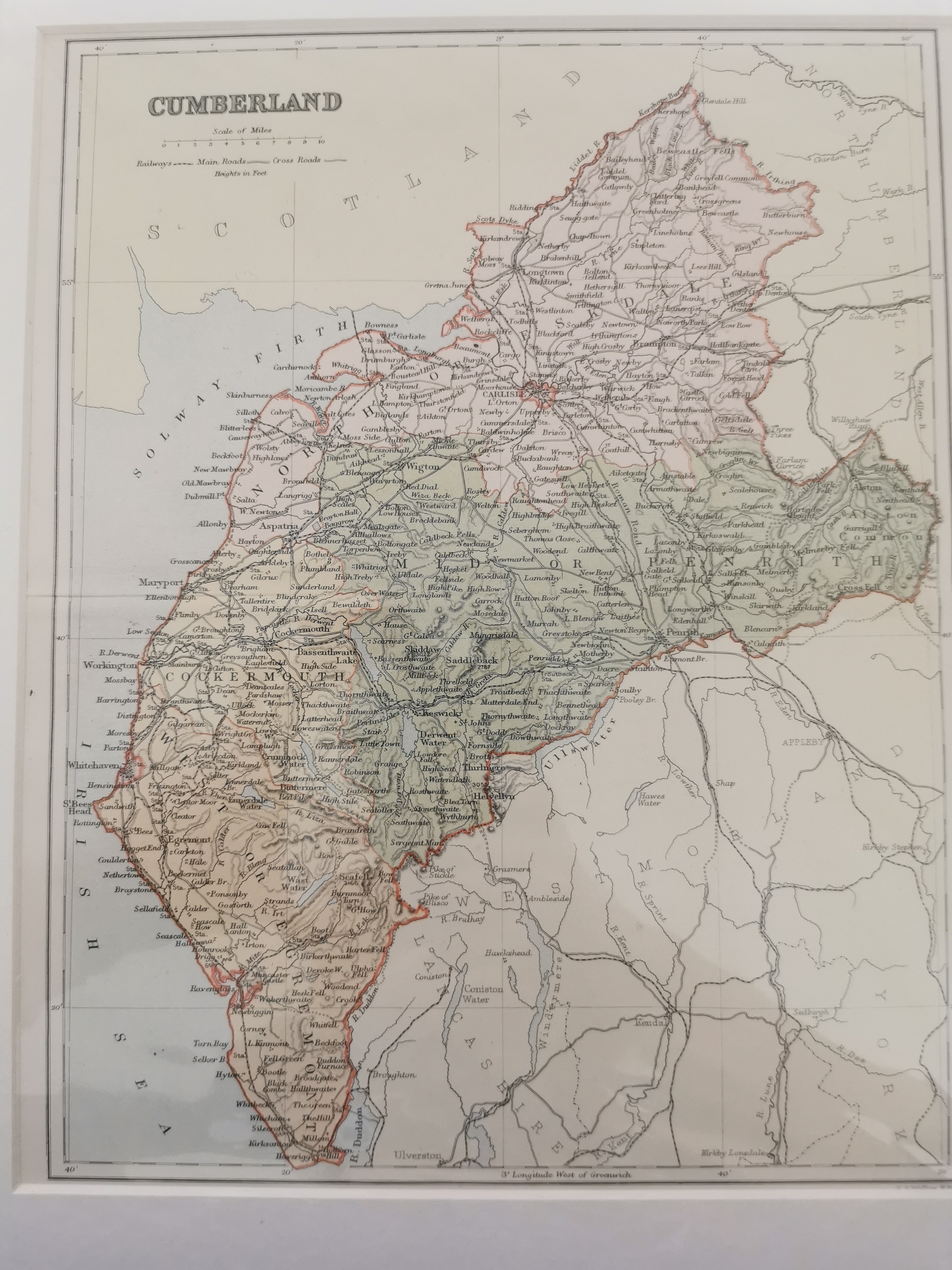
Indeed, we almost go from one extreme to another when looking at the map for Cumbria or Cumberland as the map calls it. This is from 1895 so is much more modern.
But it’s the map below that should put the problems into context. This is a snippet from Britain in the Dark Ages, an Ordnance Survey map from 1966, which shows just how stark the landscape might have been (I don’t doubt that we should, hopefully, know a bit more in the intervening 50+ years).
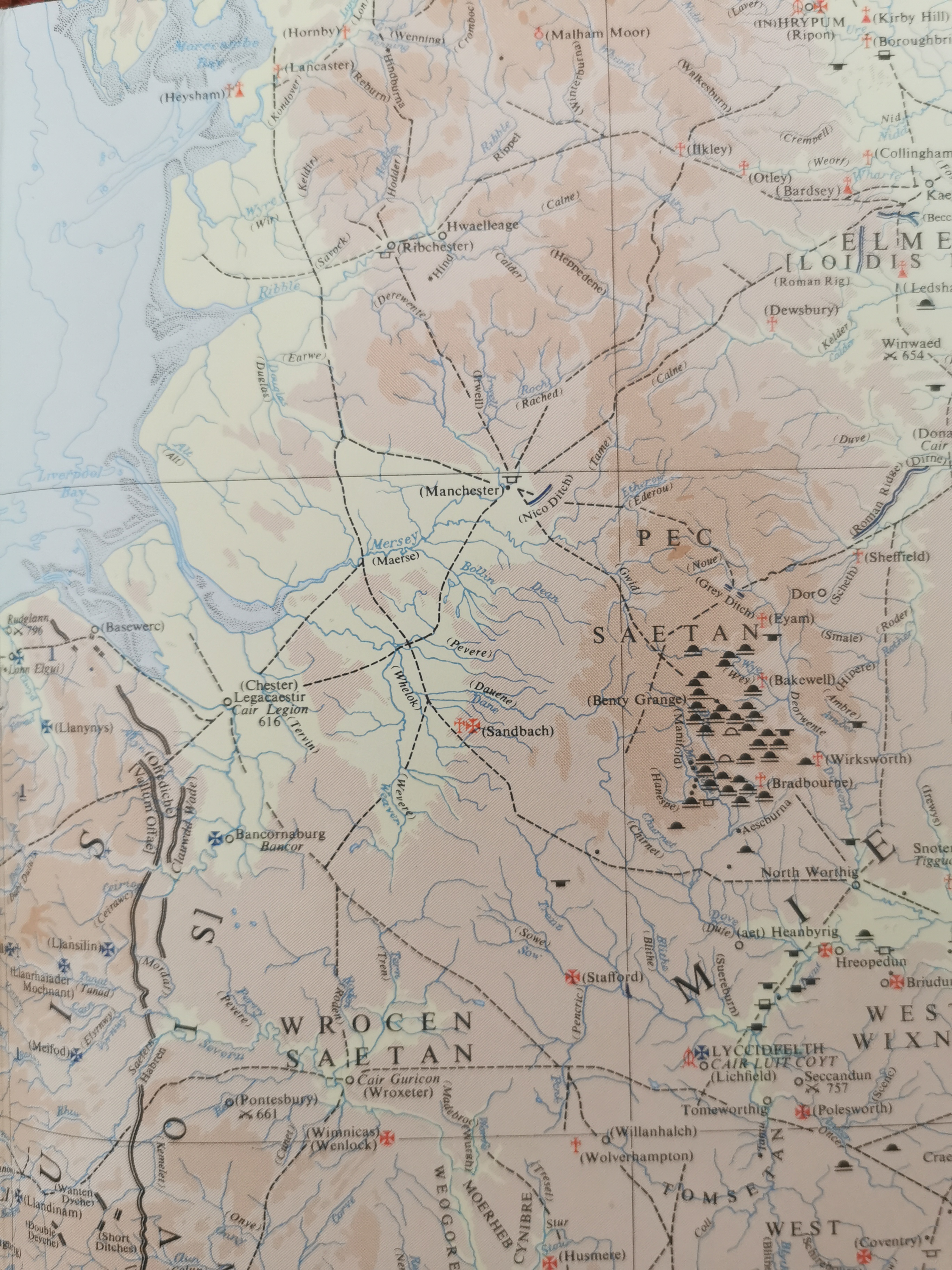
So, there’s not a lot to go on, and I’m sending poor Icel north-west, so it’ll be interesting to see what he discovers.

Protector of Mercia is released today, 5th September, in ebook, audio and paperback. The hardback will be ready soon.
books2read.com/protectorofmercia
Check out the release day blog and the Eagle of Mercia Chronicles page on my blog.
Sign up to my monthly newsletter to learn more about my writing journey, new releases and special offers, and receive a free short story collection.
Discover more from MJ Porter
Subscribe to get the latest posts sent to your email.

One thought on “The setting for Protector of Mercia”