


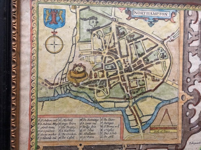
We all know that I’m a little obsessed with old maps. They’re so very helpful when trying to reconstruct Saxon England. There are a collection of maps I often use, the John Speed maps of the early 1600s, which are English county maps, often with a small cut out in the corners, of important settlements at the time. When I was writing about Northampton, the John Speed map for the settlement fitted just about perfectly with the archaeological research that’s been conducted on the remains of the Saxon settlements. I find them very helpful for a sense of scale, and how they might have ‘sat’ in the surroundings. Modern maps don’t quite give the same sense, because they’re very busy with later building work and settlements.

But below is a fascinating map, dated from 1695, which reflects what was thought about Saxon England at that date.
The reason that I love this map is because if you look really close, you can see the name Brunanburh, close to Bebbanburg (Bamburgh) on the north east coast.
This is particularly intriguing. As I’ve said elsewhere, there’s been more discussion about where the battle of Brunanburh took place as opposed to its actual significance. The current thinking is that it quite probably took place on the Wirral, and so to the west of the country and not the north east at all. But, the logic for placing the battle close to the boundary with what would become Scotland works on a very English-centric view. The enemies of Athelstan were the kings of the Scots and of Strathclyde, along with the Norse of Dublin, who hoped to regain the powerful Jorvik, or York. Why then fight on the Wirral when they were powerful elsewhere?

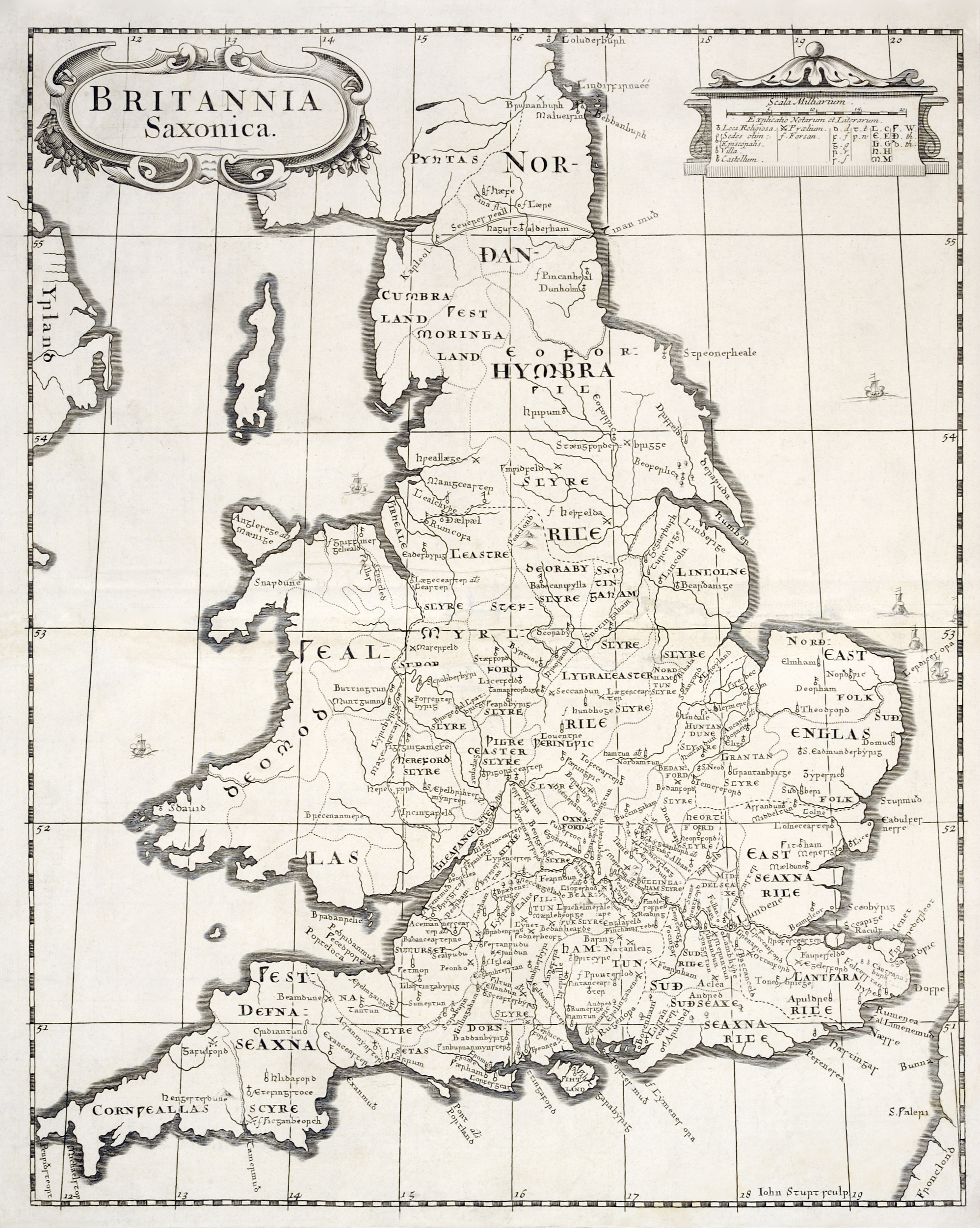
It might be a little easier to see on the image above as opposed to on the map I have. Using old maps, before much of the infrastructure we now have, is a bit like peeling back the layers of soil in an archaeological dig. I find them so helpful, and I guess I am lucky that my Dad is a ‘map man’ and I can call him, with my very strange requests and he can send me back images of exactly what I want.
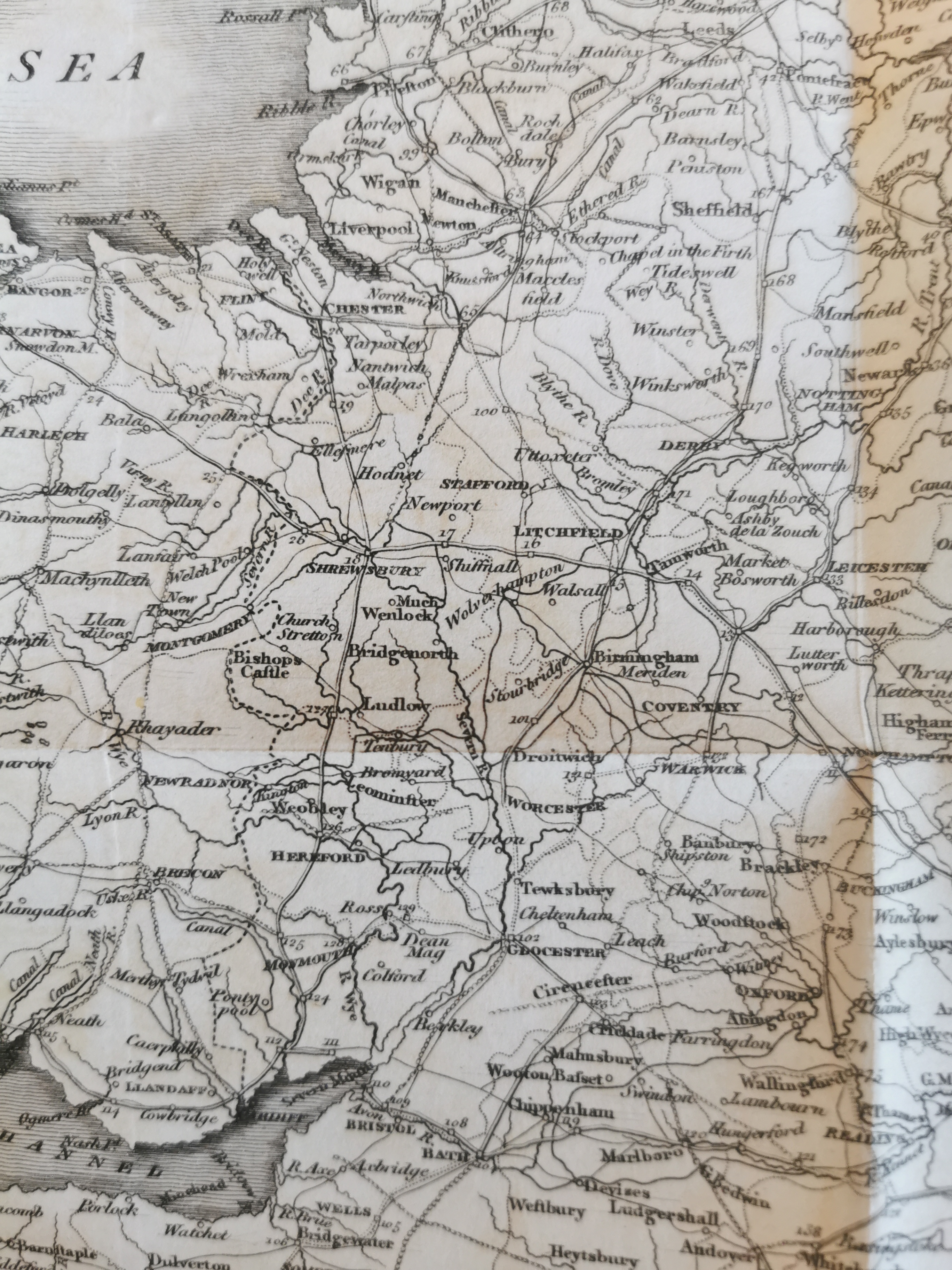
Another map I’m lucky to have my hands on is one from an 1809 printing of Richard of Cirencester’s Description of Britain. This contains a map of Roman Britain, and the roads that were then believed to have existed.
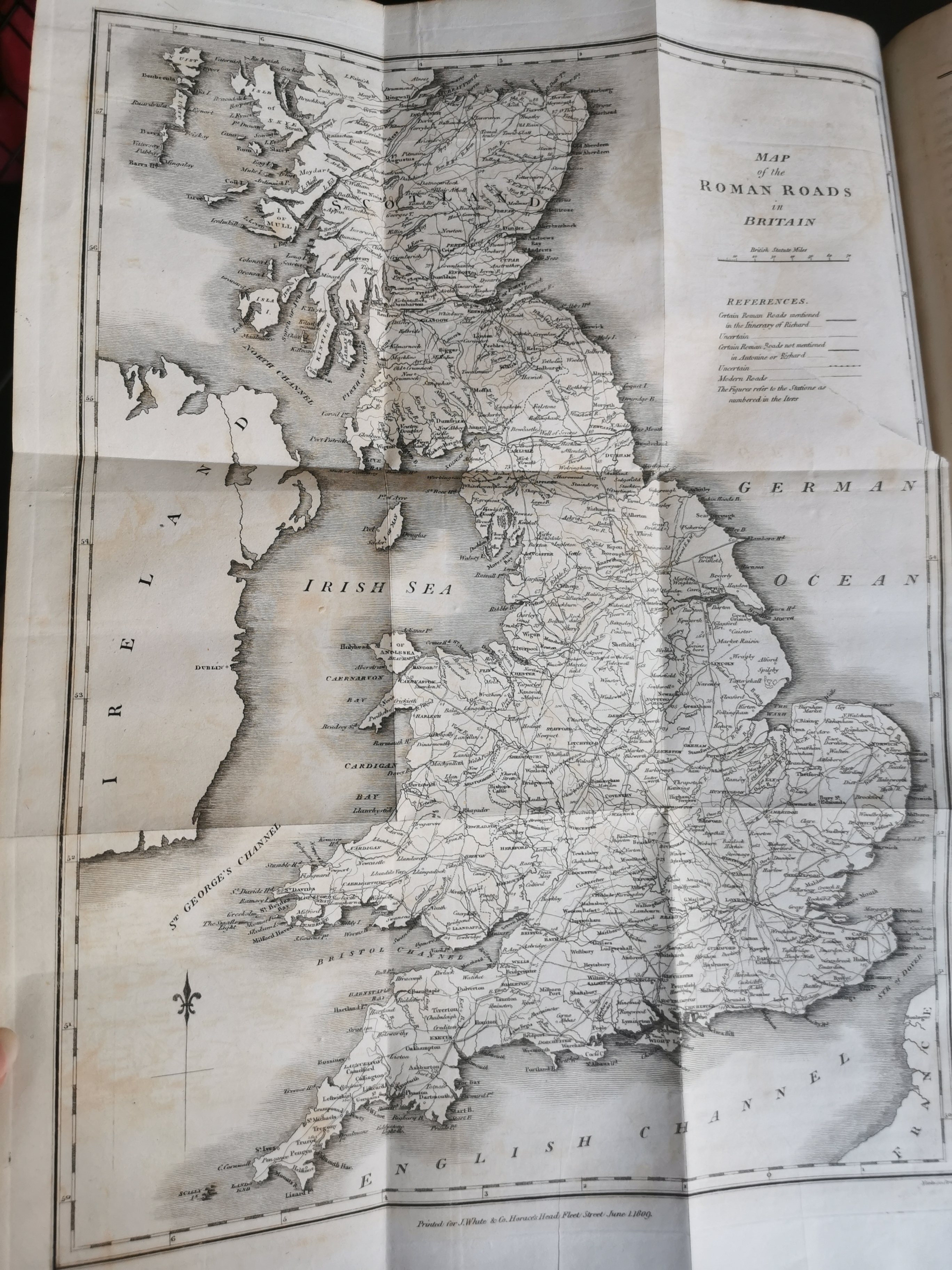
I’m hoping to use it to give me an idea of how the border region with Wales might have been connected, but it is proving a little stubborn, as many of the roads are thought to be ‘possible.’ So, old maps don’t tell you everything you want to know:)
If you’re interested in old maps, have a look on eBay and places like that, where copies are often available for sale quite cheaply. You can also get a book with all the John Speed county maps reproduced in it, and of course, there is David Hill’s An Atlas of Anglo-Saxon England that is invaluable, if you’re lucky enough to find a copy, as it has been out of print for some time.
